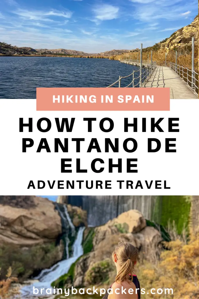
Looking for an easy, scenic hike in Elche near Alicante? Then I suggest you hike Pantano de Elche. It’s certainly a hike that surprised me. I’m usually not one for lake walks, I prefer challenging mountain tops that make you sweat until you reach the top.
But the Pantano de Elche hike had me hooked from beginning to end with so much variety from palm groves and waterfalls to scenic lake and mountain views. So much, I’ve hiked it more than once and consider it one of the best hikes in Alicante and by far one of the top things to do in Elche.
In this guide, I’ll take you through everything you need to know to hike the Pantano de Elche yourself, including the Wikiloc map I recorded on my first hike there.
Disclosure: This post may contain affiliate links. That means that if you make a purchase through one of those links, I will get a small commission at no extra cost to you.

Hi, I’m Linn Haglund, the face behind Brainy Backpackers. I’ve been based in Spain for the last 10+ years, and travel locally and abroad whenever I have a chance. I’m passionate about responsible travel, slow and off the beaten path travel, and outdoor activities, especially hiking. I’m currently slow traveling in my van Persistence (Persi among friends) with my fiancée Mohammed and rescue puppy Atlas. I’m excited to help you explore this planet responsibly!
PIN IT FOR LATER!
Hiking specs
🏠Trailhead: Aparcament del Pantá d’Elx, Alicante Spain
👣Type of trail: Loop
🥾Distance: 9.7 km
⏰Hiking Time: 2.5-3.5 hours
⛰️Difficulty: Easy
🍃Hiking season: mid-September-mid-June
🐶Hiking with dogs: Hiking with dogs is allowed. It’s also safe in the Pine Processionary Caterpillar season. There are just a few pine trees in the parking area, but we didn’t see any nests in any of the trees in the season – just be aware of them if you see them and watch your dog when you’re at the parking, the rest of the trail is pine tree free. There are also natural water sources on parts of the trail for your dog, but I’d bring some extra on a hot day.
👉JOIN OUR FACEBOOK GROUP FOR SPAIN AND PORTUGAL TRAVEL TIPS!
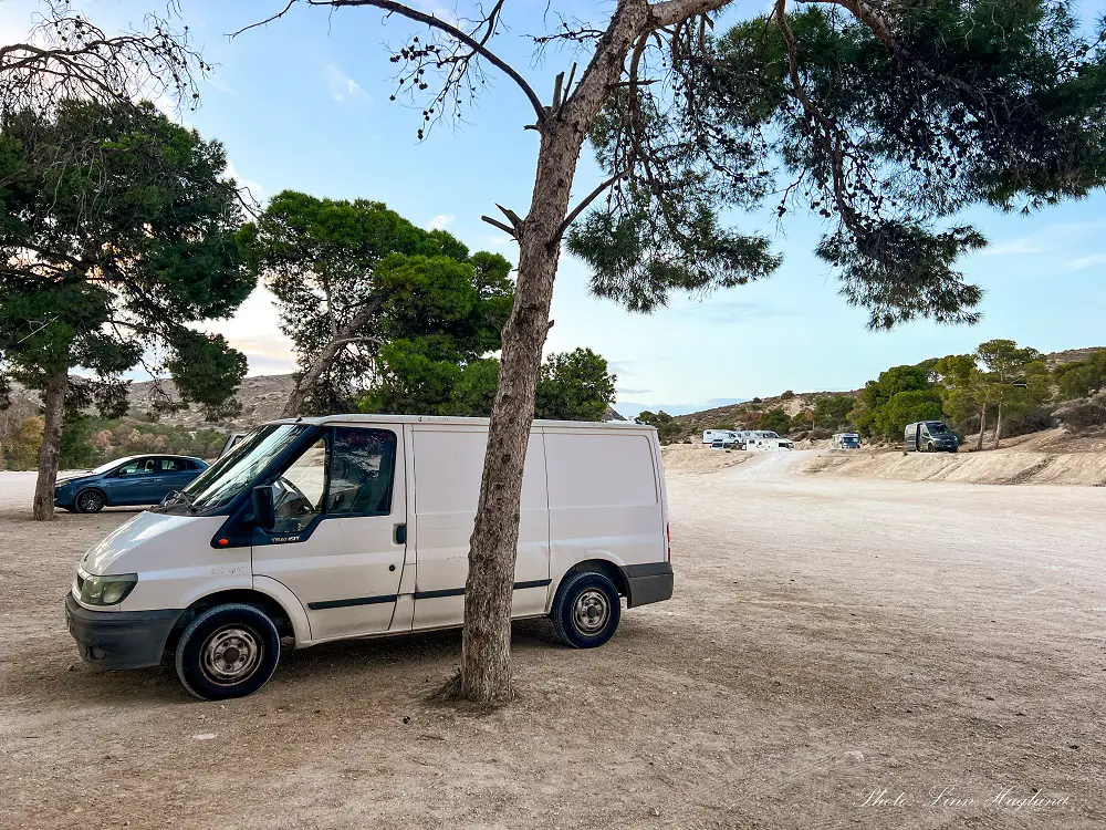
How to get to the trailhead
The hike of Pantano de Elche starts a short drive from the city center at Aparcament del Pantà d’Elx. It’s a spacious dirt parking area with 2-3 different levels which is super popular among campervans.
If you’re campervanning in Spain, I highly recommend staying there when visiting Elche. If you don’t drive, you’llhave to add an hour walking each way from Elche bus station or the city center.
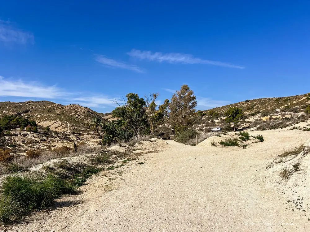
From the parking area, with your back towards the road you came from looking at the parking, follow the dirt road towards the left.
Walking with the parking areas on your right side, you’ll soon meet the trail.
I highly recommend downloading the app Wikiloc (it’s only about 10 Euros a year) and following the route I recorded on our first hike around Pantano de Elche.
This way, not only can you follow the trail, but you can also get driving descriptions to the trailhead which is ideal.
FOLLOW THE TRAIL ON WIKILOC
Hiking Pantano de Elche
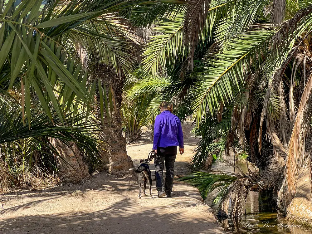
The hike starts from the parking of Pantano de Elche as described above. Shortly after starting the hike, there’s a small staircase going down to the left.
You can choose whether you want to walk down it or go straight. I prefer the walk down as it follows along the water through tall palm trees.
For some reason, this section of the hike takes me back to an oasis I visited in the Dasht-e Kavir desert in Iran, called Garmeh.
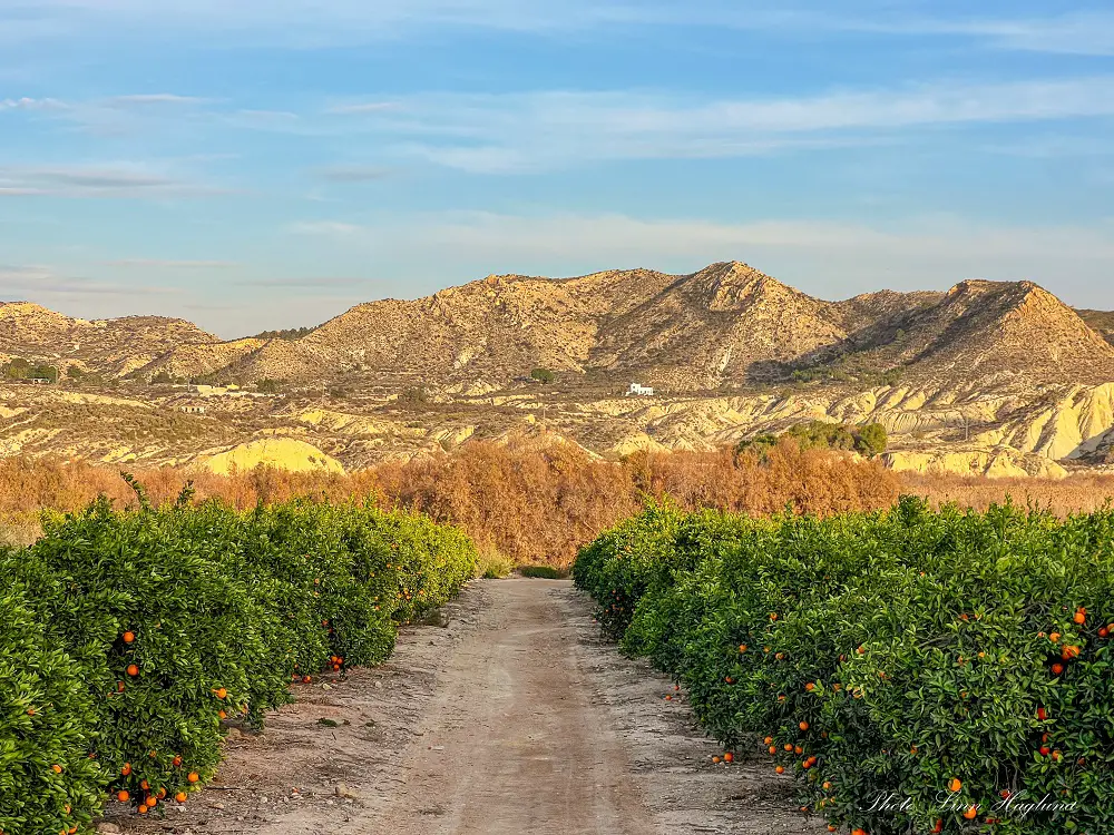
Considering Elche is regarded as an oasis in Spain with its UNESCO-listed palm groves, the resemblance might not be so strange after all. This is easily one of my top reasons why Elche should be on your bucket list to visit.
After following this path for a little bit, it opens up, and shortly after, there’s a small bridge to your right crossing the river. The hike continues upwards a few meters before it levels out again.
Shortly after, you can take a small detour down crossing the river (you need to jump there, but it’s narrow so pretty easy. There’s a beautiful little waterfall there that we really enjoyed.
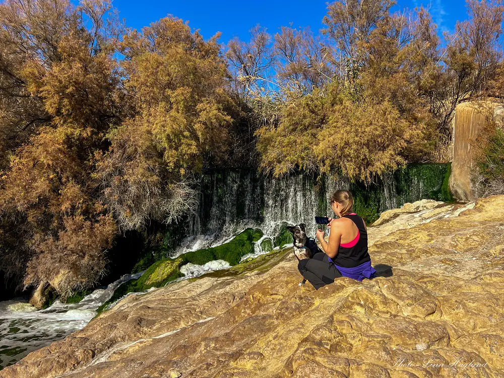
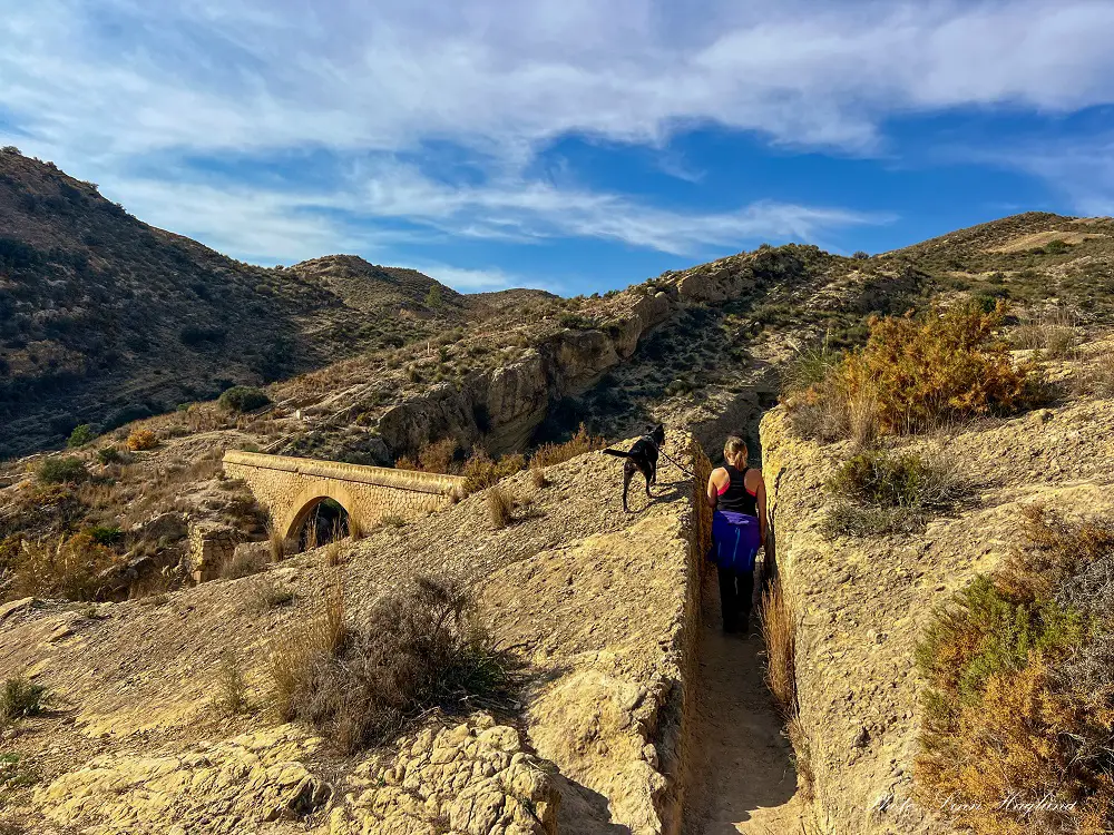
After exploring the waterfall, jump back across the river to get back on the trail. It continues straight for a while before you reach a couple of aqueducts. There, it takes you up to the right, through a small narrow path cut between the rock, and down a set of stairs.
Keep walking, cross another little bridge, and not long after, you’ll reach the big waterfall at the great Dam of Elche, where the Electricity plant is. I’ve been to many dams in Spain, but this one is incredibly beautiful!
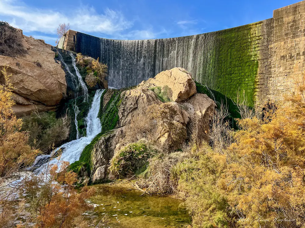
From the waterfall and dam, the trail takes you up a set of steps on the right side of the waterfall (don’t forget to turn around on the way up to enjoy the views!)
Shortly after reaching the top, the trail takes you onto a walkway along Pantano de Elche, and the scenery changes.
It’s so beautiful with the mountains as a backdrop. I really enjoyed this part of the trail because of the different layers and it’s a nature photographer’s paradise! Yup, that’s me!
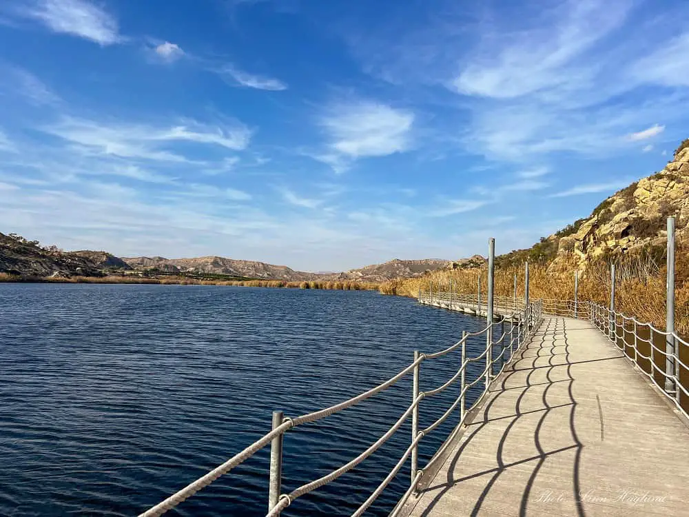
The walkway isn’t very long but adds a lot to the hike. Continuing off the walkway, the trail is easy to follow and soon it takes you through a dry, eroded area which made us feel like we were walking through a desert landscape.
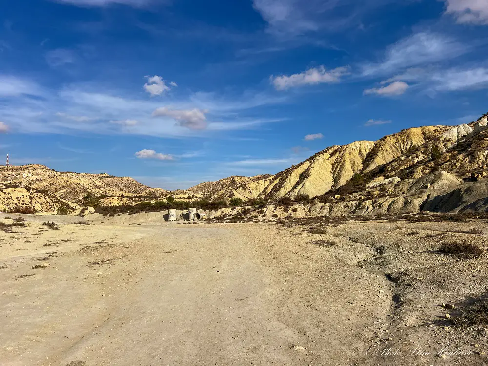
Follow the wide trail until you get to a dirt track where you have to turn either left or right. There, you have to turn left. (going right, you’ll hike to the CAU de Elche, an incredible outdoor museum amidst nature.)
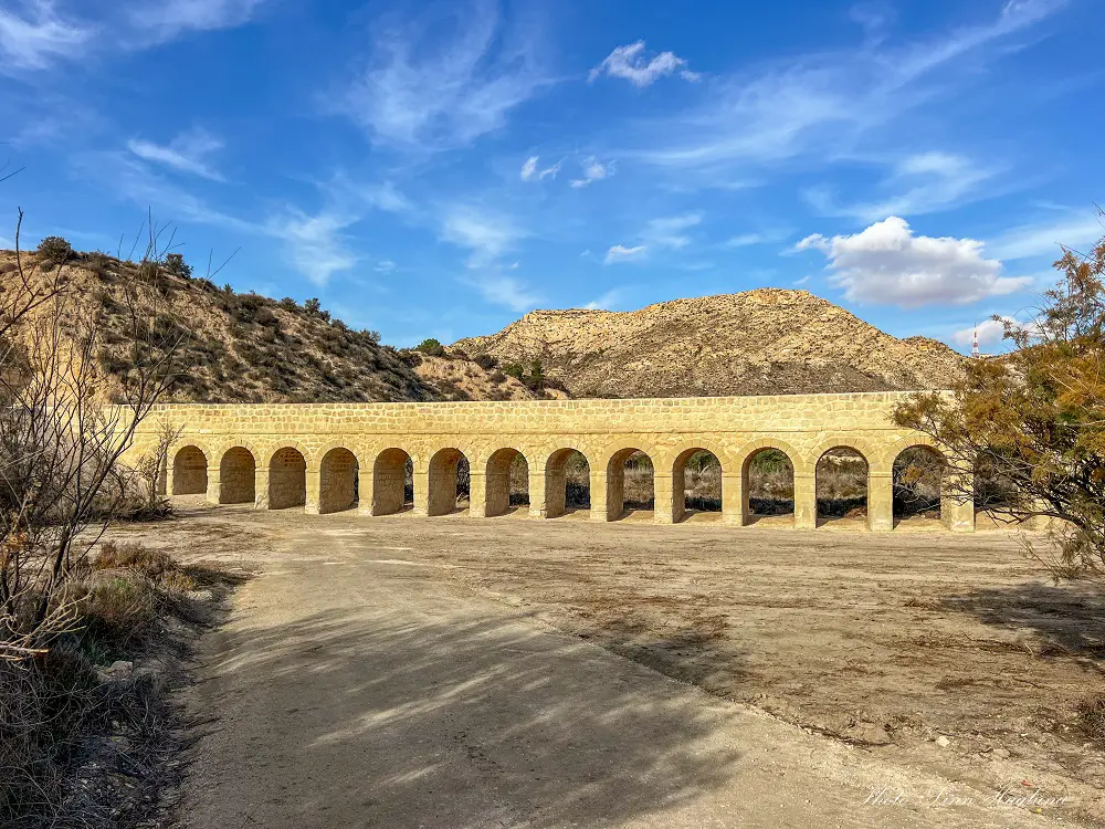
You’ll pass several aqueducts on the trail but don’t miss out on the largest renovated aqueduct on your right hand. It has more arches than I could be bothered counting. It was a really cool addition to the hike.
Following the road past the aqueduct, you’ll come across a small bridge on your left taking you across the river. When we walked there, there was some work on the road, but it was still possible to cross it.
After the bridge, the trail takes you through a little forested area before it opens up and you have to turn left (direction of the lake.)
When you reach a fork, take the right path down a narrow paved road (if you follow my Wikiloc recording you’ll see we walked left first and turned around, you don’t have to make the same mistake!)
When we were there, the sides of this road were collapsed, so I’m not sure a car could get by.
This paved road continues until you get the lake views again and there are some short but steep climbs up and down before you get to a fence blocking the road and a sign saying “Private Property”.
We took a small path on the left before the fence and walked through the orange groves on the private land (respectfully) as we didn’t see an alternative route. Some cyclists and hikers did the same route as us. Not sure if there’s another option to get past this orange land.
We struggled a bit to find the way out of there as there were some branches blocking the trail, but if you follow my track, you shouldn’t get lost.
The rest of the trail takes you along the lake and past the big waterfall on the opposite side of the river of where you came.
You need to follow the trail down towards the river once you’ve passed the views of the dam and the trail divides. You’ll get to a forested section that takes you through trees and bushes.
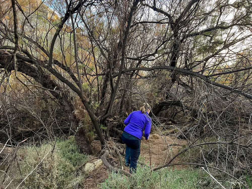
This trail is pretty overgrown some places, but eventually, you’ll get out next to one of the small bridges you crossed on the way to the dam and the rest of the path is the same as you came from.
Summing up Pantano de Elche hike
Summing up, it’s a wonderful hike that is easy to follow and has few challenges. Besides a few small steep ups and downs, it’s mostly flat so you won’t burn too much energy on this trail.
If you only have a day in Elche and want to combine it with a hike, I found this hike great to combine with a half day of sightseeing.
If you have less time to spend on the trail, walk to the waterfall and back – or to the beginning of the lake to soak in the views before turning around. It’s really beautiful.
Happy hiking!