Want to go hiking in Valencia Spain but not quite sure where to go? I don’t blame you, there are so many incredible hikes in Valencia’s surroundings and I struggled to decide where to go too.
Luckily, there are some trails near Valencia that stand out and I totally fell in love with them, having hiked some more than once.
In this post, I’ll share my favorite hiking trails in Valencia including everything you need to know to hike them yourself. Read on to uncover the stunning Valencia region’s walking trails!
Disclosure: This post may contain affiliate links. That means that if you make a purchase through one of those links, I will get a small commission at no extra cost to you.

Hi, I’m Linn Haglund, the face behind Brainy Backpackers. I’ve been based in Spain for the last 10+ years, and travel locally and abroad whenever I have a chance. I’m passionate about responsible travel, slow and off the beaten path travel, and outdoor activities, especially hiking. I’m currently slow traveling in my van Persistence (Persi among friends) with my fiancée Mohammed and rescue puppy Atlas. I’m excited to help you explore this planet responsibly!
👉JOIN OUR FACEBOOK GROUP FOR SPAIN AND PORTUGAL TRAVEL TIPS!
Best time to go hiking in Valencia
You can easily go hiking near Valencia Spain all year round, however, you should choose different trails depending on the time of year you go.
In the summer months, it gets incredibly hot, so it’s important that there’s shade on the trail, and also water to cool down during the hike. Summer hikes with waterfalls and rivers are always a winner!
In the winter months, on the other hand, it can get cold, though some days are perfect for hiking in shorts and T-shirt. Thus I don’t recommend hikes that include walking in water, as your feet will get cold quickly.
MAKE SURE YOU PIN IT FOR LATER!
Hikes in Valencia Spain
Ruta de los Puentes Colgantes
HIKING SPECS:
Where: Chulilla
Hiking time: 2-3 hours
Length: 7 km
Difficulty: Moderate
Type of hike: Linear return
Best time to hike: all year round
Hiking fee: 1 Euro (paid at the trailhead)
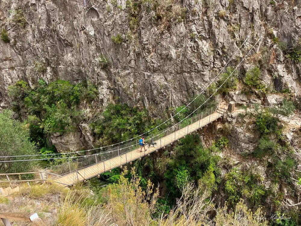
Ruta de los Puentes Colgantes is an amazing Valencia hike which is not too challenging, as long as you don’t suffer from bad knees or hard core vertigo.
It starts at the top of a breathtaking gorge in the town of Chulilla and takes you along the edge before climbing halfway down to the first hanging bridge.
Then, steep steps take you the rest of the way to the bottom of the gorge and the second hanging bridge is a short walk from there.
A little further, there is a third bridge, a low, wooden bridge, which you’re not going to cross. We did the mistake of crossing as we got extremely excited and managed to loose two powerbanks in the river (that Mohammed bravely jumped in and rescued while Atlas and I were laughing our heads off!)
The trail continues inside the gorge and the natural beauty is insane. At the end of the trail, there is a power station.
You can either turn around here, or walk up thr road (to the right) to you reach the dam. The trail instructions said to cross the dam and loop back onto the trail to return the same way, but when we were there, the entrance was closed so we had to turn back.
The lake is still beautiful, though, so it’s worth going for the views.
Ruta del Agua in Buñol
HIKING SPECS:
Where: Buñol
Hiking time: 3-4 hours
Length: 8.8 km
Difficulty: Moderate
Type of hike: Loop
Best time to hike: summer
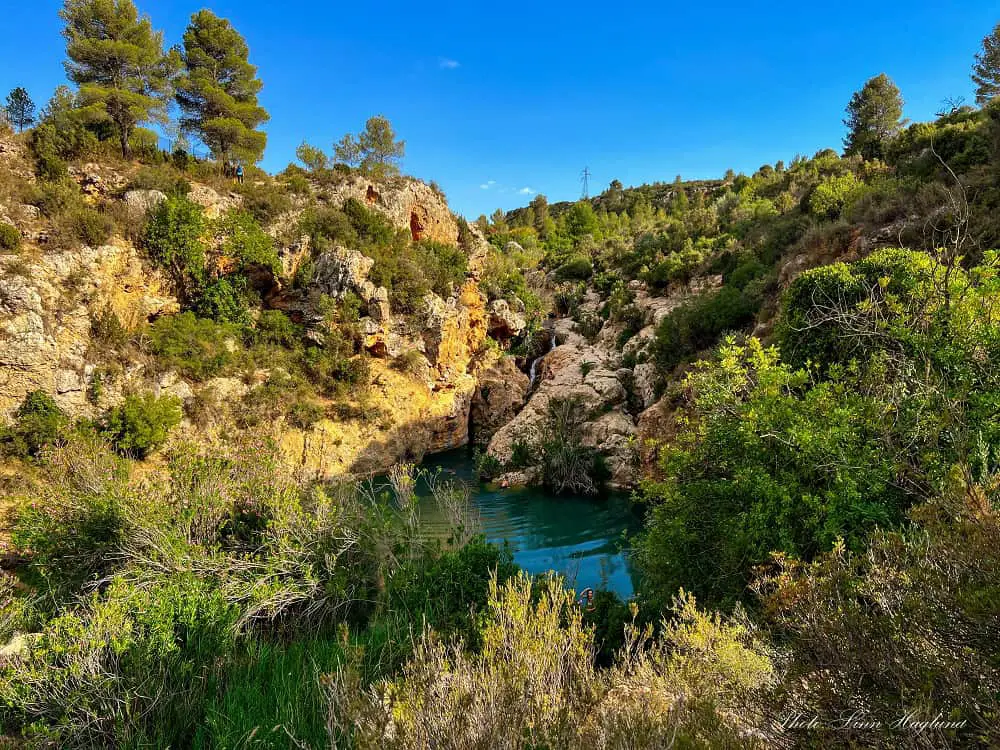
Ruta del Agua in Buñol is a stunning summer hike taking you past three epic waterfalls and several swimming spots.
First, it passes Turche Cave, which is a half an hour’s hike from Buñol, it continues along the Rio Juanes where there are several swimming stops before reaching Charco del Mañán, another stunning waterfall.
You will walk along an Asequia and there are some steep sections where you must use your hands to not slide backward down the vertical trail.
The last waterfall you’ll reach, is Cueva de las Palomas, a mesmerizing paradise overlooking a deep canyon.
This is by far one of my favorite hikes near Valencia for hot summer days as there are so many opportunities for swimming along the way, but it’s just as beautiful any other times of the year.
Ruta del Agua y Aqueducto de la Peña Cortada in Chelva
HIKING SPECS:
Where: Chelva
Hiking time: 4-5 hours
Length: 13.8 km
Difficulty: Moderate
Type of hike: Loop
Best time to hike: all year round
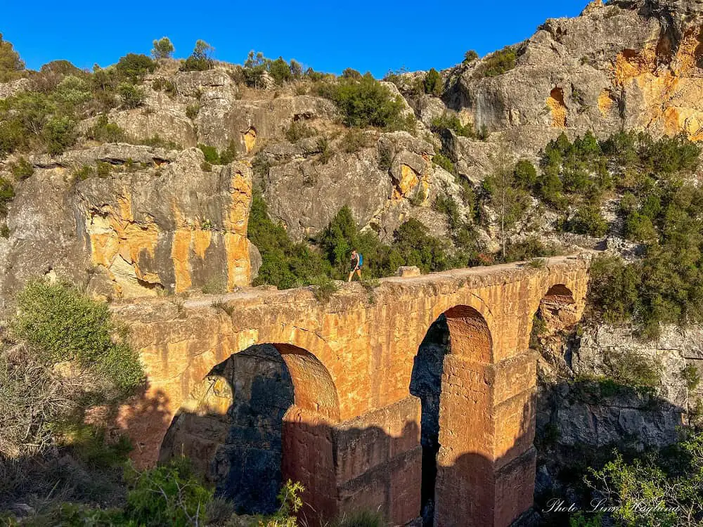
Ruta del Agua y Aqueducto de la Peña Cortada in Chelva is one of the most incredible Valencia hikes I’ve done and should definitely be on your Spain bucket list. There is so much variety to the route that it feels like 3 different hikes.
It starts with the Ruta del Agua (Water Trail) along the river from Molino Puerto recreational area where some of the highlights along the way are prehistoric caves in the rock walls and an old electricity station that sourced light to the town of Chelva as the first tone with electricity in the area.
Further along, up some strenuous steps and through farmland, you get to the start of the Aqueducto de la Peña Cortada trail.
Taking you into beautiful nature with hanging bridges and beautiful views, the highlights of this second part of the hike are multiple caves in the mountain wall with stunning gorge views in between and a 1st-century Roman aqueduct.
Read my complete Chelva itinerary (including this hike)
Peñon de Ifach
HIKING SPECS:
Where: Calpe
Hiking time: 2-3 hours
Length: 5 km
Difficulty: Moderate-Challenging
Type of hike: Circular
Best time to hike: all year round (but summer gets hot!)
Permit required: BOOK HERE (free)
Peñon de Ifach is one of the most iconic hikes in Valencia. The 332-meter tall rock juts into the sea in the town of Calpe, which is one of the most sought-after coastal towns in Spain.
Yet, hiking Peñon de Ifach in Calpe doesn’t come without challenges. It’s a picturesque route with endless views of the coast.
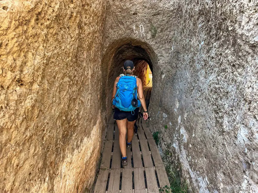
It takes you through a tunnel in the rock and there are several places where you can hold on to ropes as the rocks are slippery. Close to the top, you’ll reach sections of light scrambling.
Due to the slippery rock (starting in the tunnel), I highly recommend that you only take on this hike wearing good hiking shoes or boots with a solid grip.
I also only recommend taking dogs if they’re trained to hike in rough terrain and listen to commands as there are places with steep drops. Atlas did it without any issues, but he’s very well-trained and an avid hiker (hard not to be with Mohammed and me as parents lol.)
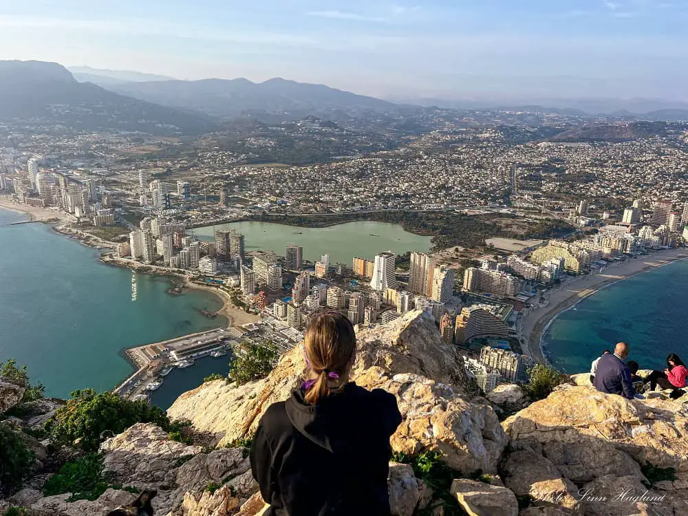
The final reward once you reach the top is unmatched views of Calpe’s coastline, town, and the lake in the middle. These views are seriously hard to beat, making this among my top hikes in Alicante.
Pantano de Elche
HIKING SPECS:
Where: Elche
Hiking time: 2-3 hours
Length: 9.7 km
Difficulty: Easy
Type of hike: Circular
Best time to hike: mid-September to mid-June
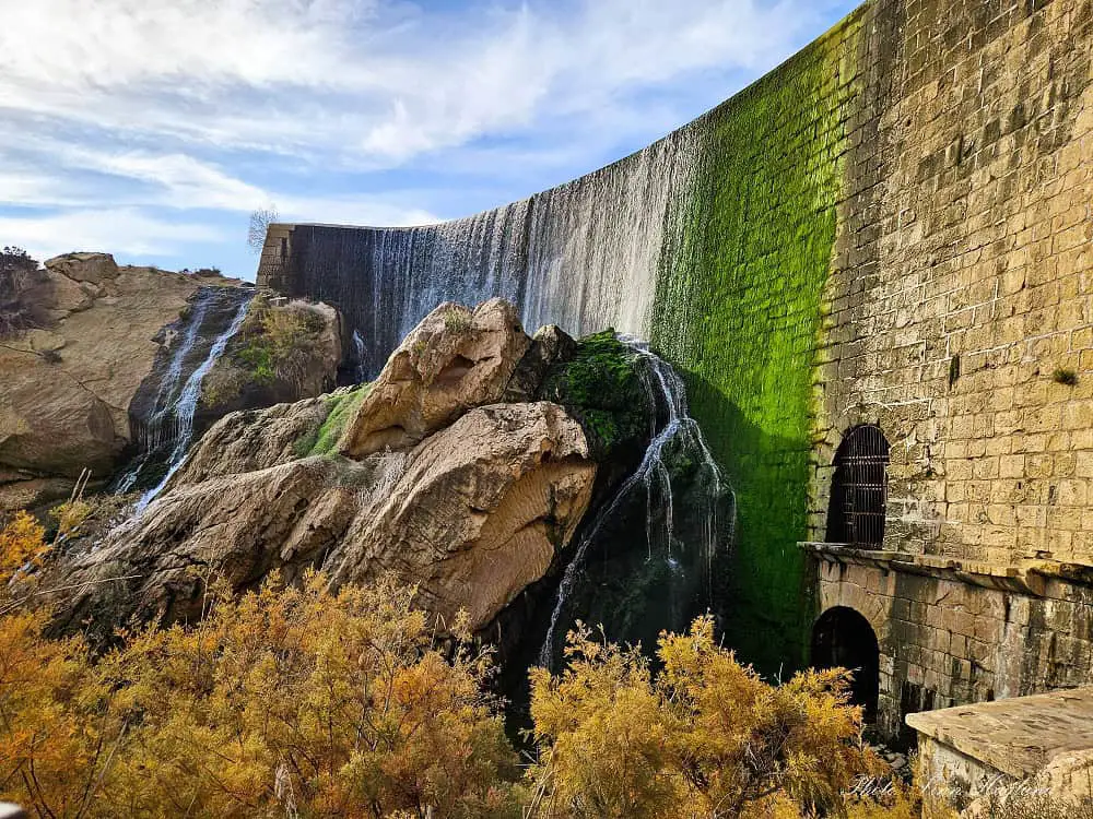
Pantano de Elche is a fairly easy hike that takes you through palm groves along the river and past breathtaking waterfalls before you reach the picturesque lake.
The vegetation is truly stunning from start to end and it’s very varied too. The mountain views as a backdrop of the lake make it a haven for photographers and the many aqueducts you’ll encounter on your way makes it even more interesting.
You’ll even wander through an orange farm (but please respect this private land and resist the temptation of picking oranges along the way!)
If you’re looking for a shorter hike, you can easily turn around by the big waterfall at the water plant, but I highly recommend walking a few more minutes up the steps to at least get a peek at the lake.
Ruta de los Pontaneros
HIKING SPECS:
Where: Chulilla
Hiking time: 5-6 hours
Length: 16.7 km
Difficulty: Moderate
Type of hike: Loop
Best time to hike: October-May (too hot in summer)
Hiking fee: 1 Euro (charged at the trailhead)
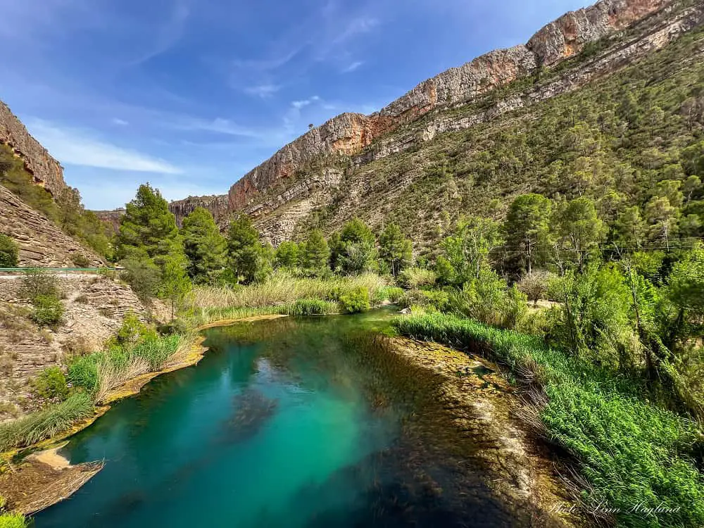
Another fantastic Valencia hiking trail is Ruta de los Pontaneros in Chulilla. It starts with the beautiful Ruta de los Puentes Colgantes, but instead of turning back through the gorge, it loops around the hills for epic lake views and continues into the forest.
The forested trail seems to follow a riverbed, so I recommend good footwear as there is some scrambling down rocks some places (at least if you’re as small as I am.) I had to help Atlas down a couple of rocks, but he did most of it himself (at almost 9 months old.)
I also recommend taking the detour to find the prehistoric cave paintings. It’s well marked from the trail, but once you leave the trail, we didn’t find them.
After walking back on the trail, we could see where they are, but didn’t want to walk back in, so skipped it. It seemed like some rocks had fallen over the trail where you climb up to the cave which is why we didn’t see it.
When you reach the beginning of the village, continue into the Charco Azul before looping back up to the village. It’s a fantastic little detour!
Cueva del Turche
HIKING SPECS:
Where: Buñol
Hiking time: 1 hour
Length: 3.8 km
Difficulty: Easy
Type of hike: Linear return
Best time to hike: summer
Cueva del Turche is an easy but stunning hike in Valencia’s small town of Buñol. It’s only about half an hour ti hike from the village to the Cueva del Turche swimming hole and waterfall.
This is a fantastic summer hike as you get to swim and cool down at the waterfall, however, there isn’t that much chade along the trail and it gets hot.
But since it’s so short, it’s not that bad and well worth it for the epic destination you’re hiking to. That said, this is a great all year round hike if you’re not going for the swim. Especially after the wet season in winter, you’re more likely to experience a powerful waterfall.
Charco Azul, Chulilla
HIKING SPECS:
Where: Chulilla
Hiking time: 1-1.5 hours
Length: 4.2 km
Difficulty: Easy
Type of hike: Loop
Best time to hike: summer
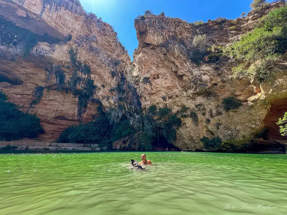
Charco Azul in Chulilla is a fantastic place for hiking near Valencia Spain for the entire family. It’s fairly easy from the village.
The most natural place to park is at the top of the village before entering, which means you’ll hike through the village to the bottom where you’ll find a small parking space and signs pointing to Charco Azul.
You’ll walk a well-marked route to the swimming hole at the bottom of the gorge. On the way, you’ll pass a small natural river beach which is great for swimming too. Besides, there are natural caves you’ll walk through.
On the way back, swing to the left just after turning back until you reach the path along the gorge wall. This will climb up the side of the gorge and you reach a cool cave you can go inside on the way back to the village.
There are basically several options for going there and returning and we tried a few when we were there, so don’t fret if you wonder if you went the right way, they all lead to the same destination.
This is a great small hike that you can combine with visiting Chulilla village.
Pantano de Relleu & Pasarela de Relleu
HIKING SPECS:
Where: Relleu
Hiking time: 2.5-3.5 hours
Length: 9.5 km
Difficulty: Moderate (not a good match with vertigo!)
Type of hike: Loop
Best time to hike: mid-September-mid-June
Entry fee: 3.50 Euros
Opening hours of the walkway: Monday to Sunday 10:00-17:30 (last entry 17:00)
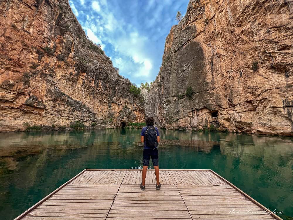
Hiking Pantano de Relleu and the thrilling Pasarela de Relleu as a loop trail from Relleu village is a fantastic experience!
We loved doing the entire trail and not only the walkway as it takes you through stunning nature. You can park right below the village and start from there or from the Town Hall.
If you travel by camper van as we did, there’s a great spot to park by the castle runs with toilets and the walk down through the village is only about 10 minutes.
The path isn’t fantastically marked in the beginning, but when the signposting starts, there’s no way to get lost.
The highlight of this hike is without a doubt the Pasarela de Relleu, which is a wooden walkway pinned about 60 meters above the ground in a stunning, narrow gorge.
For all the information about booking entry slots in advance and how to get there (including my recorded Wikiloc route,) check out my complete hiking guide.
Reflections on Valencia’s hikes
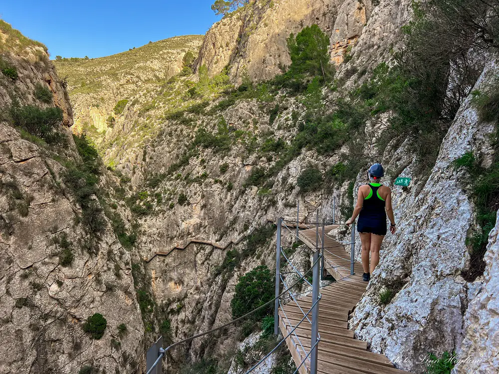
When it comes to hiking, Valencia province was really surprising. I had no idea that there were so many grand hikes around Valencia.
As the hiking enthusiast I am, I was really excited to go on these and was not one bit disappointed, so I think you will enjoy them too!
Happy hiking!
