Looking for epic hikes in Spain for your next adventure?
Look no further!
After calling Spain home for over 10 years and hiking being my favorite hobby, I’ve covered some of the most stunning hikes in Spain and I’m here to share them with you.
Taking up most of the Iberic Peninsula, Spain has a beautiful blend of rocky peaks, pine tree forests, rolling hills, silver-green olive fields, dry desert land, rugged cliffs, and white fine-sanded beaches.
It’s a true haven for any outdoor enthusiast with gorgeous day hikes up tall peaks with breathtaking views or along vivid rivers winding through canyons to multi-day pilgrimage treks. Spain’s Camino was rated among the best hikes in Europe in 2024.
While I’ve spent a lot of time hiking in Spain I’ve partnered up with a few other outdoor enthusiasts so that you can enjoy the best of what this country has to offer. Let’s bring on the itchy feet!
Disclosure: This post may contain affiliate links. That means that if you make a purchase through one of those links, I will get a small commission at no extra cost to you.

Hi, I’m Linn Haglund, the face behind Brainy Backpackers. I’ve been based in Spain for the last 10+ years, and travel locally and abroad whenever I have a chance. I’m passionate about responsible travel, slow and off the beaten path travel, and outdoor activities, especially hiking. I’m currently slow traveling in my van Persistence (Persi among friends) with my fiancée Mohammed and rescue puppy Atlas. I’m excited to help you explore this planet responsibly!
MORE FROM SPAIN
- Best coastal towns in Spain
- Best coastal cities in Spain
- Weekend breaks in Spain
- Campervanning in Spain
- Best road trips in Spain
- Best places to visit in Spain for first timers
- Mallorca road trip
- Andalucia road trip
- Things to do in Merida Spain
- Day trip to Toledo Spain
- Is Madrid worth visiting?
- Day trip to Madrid
- Winter in Madrid
- Best day trips from Madrid by train
- Valencia 1 day itinerary
- Where to stay in Valencia
- Winter in Valencia
- Reasons to visit Valencia
- Bike tours in Valencia
- Extraordinary day trips from Valencia
⛺READ IF YOU’RE CAMPING:
👉Best pop-up tent for camping
👉Eco-friendly camping gear
👉Best tents for camping with dogs
👉Best sustainable backpacks for the eco-friendly traveler
👉Best travel books
👉JOIN OUR FACEBOOK GROUP FOR SPAIN AND PORTUGAL TRAVEL TIPS!
Best hikes in Spain
Mulhacen
🎒HIKING SPECS:
🥾Difficulty: moderate (2-day: moderate to demanding)
👣Length: 11.5 km (2-day: 24.5 km)
🚶♀️Hiking time: 4-5 hours (2 days)
🧭Type: Linear return (2-day: Loop)
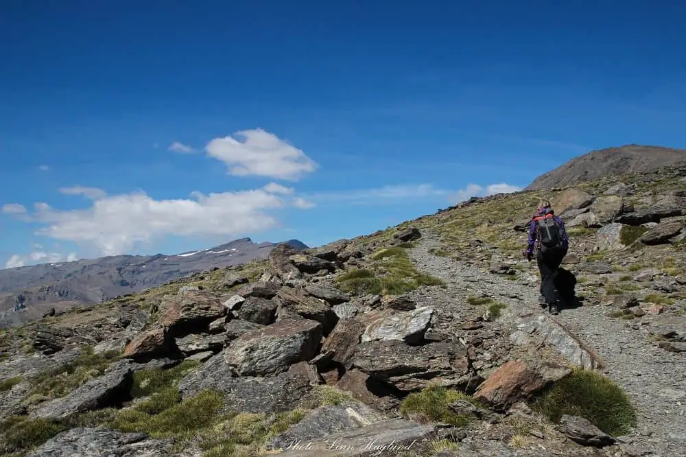
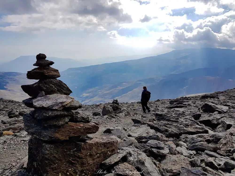
No list of hikes in Spain is complete without the Mulhacen hike in Sierra Nevada, the highest peak in mainland Spain, and the entire Iberian Peninsula with its 3479 meters of altitude!
It’s also an easy day hike if you take the shuttle bus from Capileira to Mirador de Trevelez and walk from there. The shuttle bus will pick you up 6 hours after drop off which gives you plenty of time to enjoy the walk up and take as many photos as you like, including a lunch break.
The hike is not hard in itself, but the altitude can make it tough, especially if you travel straight from the coast on a day trip.
Mulhacen can also be done in two days by hiking from Hoya del Portillo to Poqueira Refuge where you will spend the night before climbing to the top of Mulhacen on day 2.
This is a lot harder than the one-day trek as you’ll ascend Mulhacen on the opposite side which is incredibly steep. But nothing is more rewarding than reaching the top after a hard climb! This is by far one of the top Spain bucket list experiences you can have.
El Caminito del Rey
🎒HIKING SPECS:
🥾Difficulty: easy
👣Length: 7.7 km
🚶♀️Hiking time: 2 hours
🧭Type: Linear
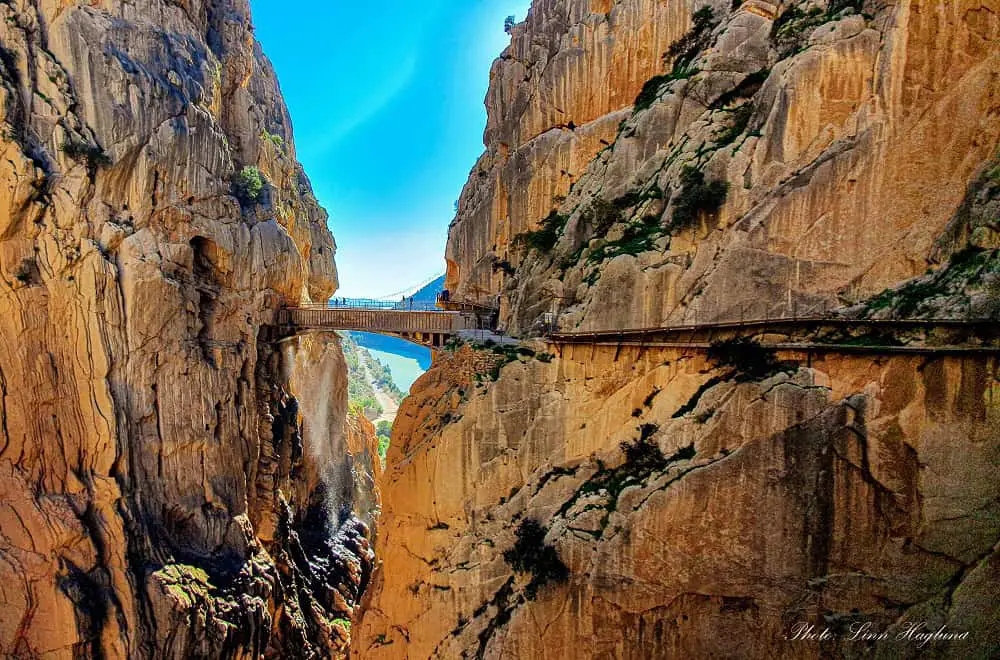
The most famous hike in Spain, El Caminito del Rey! It used to be the most dangerous footpath in the world, hanging on the vertical cliff of the Gaitanes Gorge in Ardales, Malaga. That was before the trail was restored and opened to the public again in 2015.
The old path, which is completely gone in several places, still sits beneath the new, secure footpath to remind visitors about the original structure. A memorial is made to those who died in the attempt to hike there before the trail was rebuilt.
The 8-kilometer hike is linear and flat. It goes through a forested area, continues along the river, and ends with the breathtaking (literally!) boardwalk along the cliffside, more than 100 meters from the ground. The hike will normally take you around 2 hours to complete.
You need a ticket to do the hike and will not be allowed to enter unless you have a ticket for the exact time slot of your arrival. at the checkpoint, you’ll get a mandatory helmet that must be worn during the entire walk.
The hike is one way, starting from El Kiosko restaurant. There is a shuttle bus that costs 1.55 Euros between El Chorro (outside the train station and the end of the trail) and El Kiosko. From the restaurant, it takes about 20 minutes to walk to the checkpoint, so make sure you plan for enough time to get there for your time slot.
Tickets sell out quickly, so I recommend purchasing them online as early as possible. This is one of the few hikes I highly recommend joining a guided tour to learn more about the history and geology of this unique walk.
Ruta del Agua y Aqueducto de la Peña Cortada, Chelva
🎒HIKING SPECS:
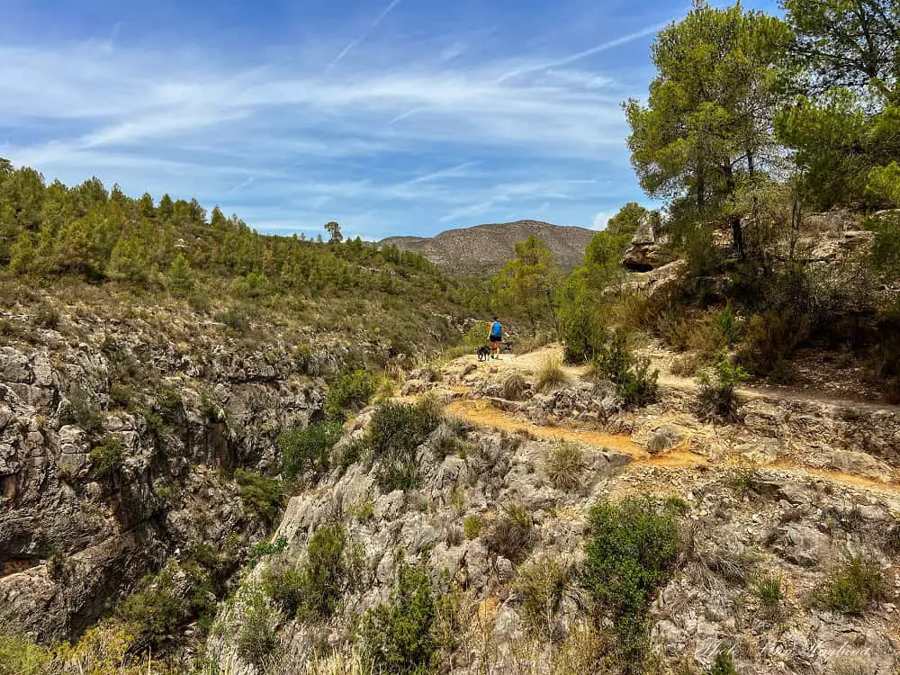
🥾Difficulty: moderate
👣Length: 13 km
🚶♀️Hiking time: 4.5 hours
🧭Type: Loop
Ruta del Agua y Aqueducto de la Peña Cortada in Chelva is a fantastic day hike that follows the water route from the Molino Puerto recreational area in the historic town of Chelva.
This is truly one of the most incredible day trips from Valencia, but if you have more time, I recommend spending an extra day exploring the town. There is so much to do in Chelva with its charming Moorish and Jewish neighborhoods.
Following the water route, you’ll also ascend to the top of the gorge where you’ll be treated to the best views of Chelva town. There are some views of prehistoric caves in the rock on the opposite side of the gorge and at this viewpoint, you’ll turn down again towards the river.
It’s easy to follow most of the way and after a while, you’ll climb up a set of steep steps. Eventually, you’ll leave the Ruta del Agua and enter the aqueduct route.
This is by far the coolest part of the hike where you’ll follow a wooden boardwalk that is built through tunnels on the mountainside with stunning gorge views in between.
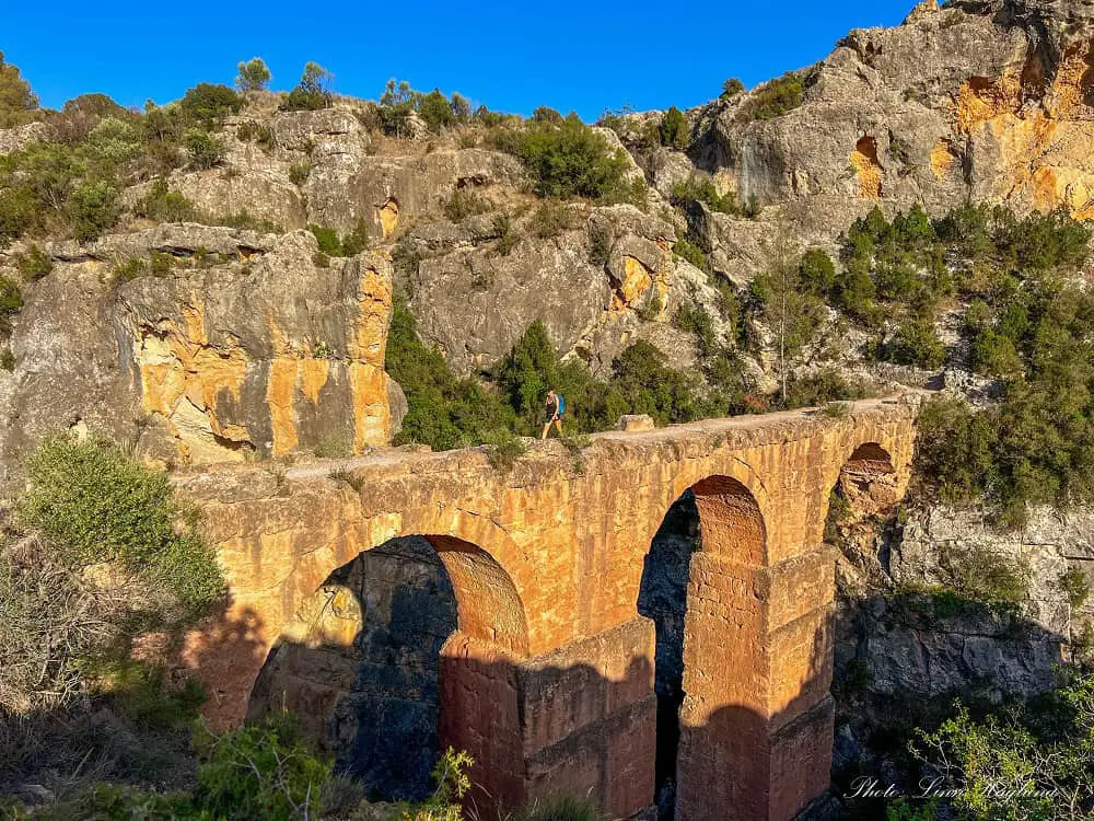
This fun path follows along for a while before you cross a 1st-century Roman aqueduct. Be cautious if you have vertigo! It’s narrow and it’s steep down on each side!
The rest of the trail is easy looping back to the village. Take note of the old washing place as you enter Chelva again.
Ruta de los Pontaneros
🎒HIKING SPECS:
🥾Difficulty: moderate
👣Length: 16.5 km
🚶♀️Hiking time: 5 hours
🧭Type: Loop
Ruta de los Pontaneros starts right outside the picturesque town of Chulilla, less than an hour from Valencia, and is not only among the most beautiful hikes in Valencia but also one of my favorite hikes in Spain.
It starts right below the village along the road and it costs 1 Euro to enter the gorge (though there wasn’t anyone there to take money when we did it in early June,) so make sure you have cash.
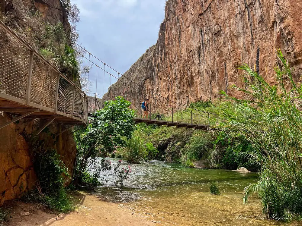
The hike starts in the deep gorge and crosses several hanging bridges. At the end of the Ruta de los Puentes Colgantes, you’ll continue on paved road and dirt track for a while where you get sweeping views of the gorge and the turquoise Embalse Loriguilla lake.
Eventually, it takes you through a forested trail where you can take a small detour to see a cave with prehistoric rock paintings before looping back towards the village.
Instead of continuing through the village, take a detour to the mesmerizing Charco Azul, a waterhole at the bottom of the gorge. I love this hike as it’s so varied and there is so much beauty.
If you go in the summer, I recommend only doing the Ruta de los Puentes Colgantes (The route of the hanging bridges) and return the same way.
On this route, you get more shade and though there is a lot of current in the river, there are a couple of places you can dip if you’re careful. You can also do Charco Azul separately from Chulilla which only takes about an hour return and there is a small beach in the river where you can swim before reaching the waterhole.
Ruta del Agua, Buñol
🎒HIKING SPECS:
🥾Difficulty: moderate
👣Length: 8.8 km
🚶♀️Hiking time: 3-4 hours
🧭Type: Loop
By Laura of Travelers Universe (edited by Linn Haglund after doing the trek in June 2024)
The breathtaking Ruta del Agua in Buñol (Water Route) is less than an hour’s drive away from Valencia. It’s a fully signposted route and it features a landscape of great beauty. It roughly takes half a day to complete and it’s one of the best day trips from Valencia.
You can do this route without great difficulty, as it alternates with trails, paths, dirt roads, and asphalted roads. And since it’s a circular route along the Juanes and Buñol rivers, you’ll have many opportunities to enjoy new landscapes from beginning to end.
The starting point is in the town of Buñol (best known for La Tomatina Festival). From there you can access the river park promenade, which leads you to the Galán Mill where you can see a large chimney reminiscent of Buñol’s industrial past.
Following the marks that you can find along the way, you’ll arrive at the Cave of Turche, a natural place of great beauty.
A 60-meter waterfall falls over a lake from the top of the great rock wall, but in the summer it can get quite dry. If it’s a hot day, this is a great place for a first swim.
After a section on the dirt track, you’ll reach the river and there are plenty of swimming opportunities as you follow the river.
Finally, you’ll arrive at the enclave of Charco de Mañán and continue to Cueva de Las Palomas (Cave of the Doves), a place of great beauty where you can enjoy a swim.
The Cave of the Doves was formed by the erosion of the Juanes River. When the water rushes to the great pool, it forms a curtain of water that creates an incredible magical atmosphere.
El Saltillo
🎒HIKING SPECS:
🥾Difficulty: moderate
👣Length: 11.3 km
🚶♀️Hiking time: 4-5 hours
🧭Type: Linear return
El Saltillo trail is El Caminito del Rey’s little brother. Staring from the white village Canillas de Aceituno in the Malaga province, this spectacular, yet quite unknown hike takes you along the surrounding steep hills with outstanding views of green valleys spotted with olive groves. This is perfect if you want to explore hidden gems in Spain.
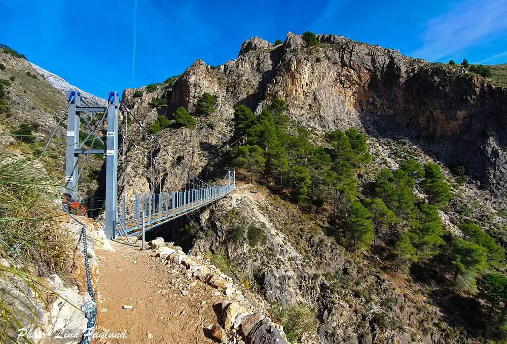
Also this hike ends with a short boardwalk along the vertical cliffside before crossing Spain’s third-longest hanging bridge.
Only, El Saltillo is free to walk, you don’t need a helmet, and not too many tourists have found their way here yet – though the hike was promoted strongly within Spain when they reopened with the hanging bridge in October 2020.
This is a 3-4-hour hike to the hanging bridge and back and 5-6 hours if you do the whole hike to the viewpoint where you get astounding views of La Maroma – Malaga’s highest summit.
The hike is narrow along the steep edge most of the way, but near the hanging bridge it’s a steep descent and after it a steep ascent. If you suffer from vertigo, El Saltillo trail might be hard.
Ruta del Gollizno
🎒HIKING SPECS:
🥾Difficulty: Moderate
👣Length: 8 km
🚶♀️Hiking time: 3-4 hours
🧭Type: Loop
Ruta del Gollizno is a fantastic hike in Spain’s wilderness taking you through a beautiful gorge and breathtaking nature.
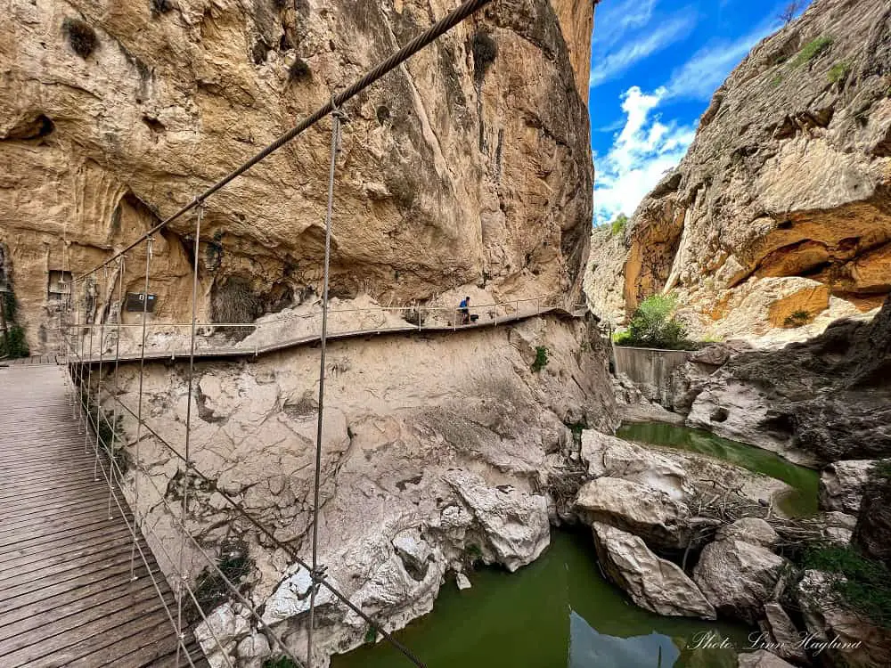
The highlight of the hike is a hanging bridge and wooden boardwalk pinned to the mountainside which if I may say it out loud, is quite squeaky!
But it’s soo worth it! the scenery is spectacular throughout the entire hike and it’s pretty well marked. However, it can be a good idea to follow the trail on Wikiloc to avoid any missed turns.
The hike starts in Olivares and loops through the charming village of Moclín where I highly recommend walking around a bit or stop for a drink or bite to eat before looping back down to the trailhead.
Ruta de los Bolos
🎒HIKING SPECS:
🥾Difficulty: Moderate
👣Length: 10 km
🚶♀️Hiking time: 4-6 hours
🧭Type: Linear return
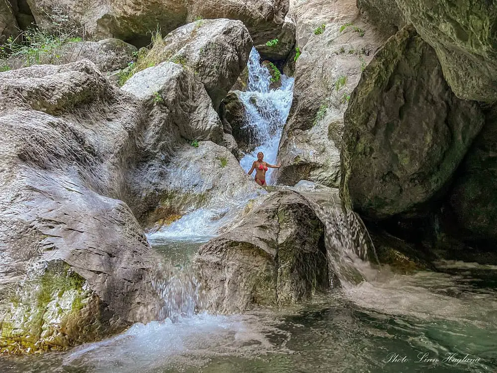
Ruta de los Bolos is a wonderful summer hike with plenty of waterfalls and swimming holes along the way (so don’t forget swimwear!) It’s one of several stunning waterfall hikes to do in Dúrcal town in the province of Granada.
Most of the hike is walking in the water, which helps keep you cool on hot days.
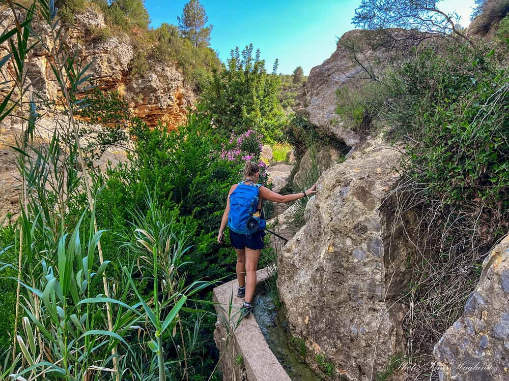
It’s mostly easy to follow, but with some challenging parts. My favorite section goes above the gorge along a narrow Acequia which includes a VERY narrow passageway. I had to take off my backpack as I couldn’t get through with the side pockets.
The last section towards the main waterfall is rocky going through the river and you might have to use your hands in some places.
The main waterfall is absolutely mesmerizing with several rock pools and makes for the perfect place for your lunch! On the way back, you can return where you came from or walk along the river to avoid climbing up to the Acequia. But it’s also possible to follow the Acequia back to the village.
Simancón and El Reloj
🎒HIKING SPECS:
🥾Difficulty: difficult
👣Length: 10.6 km
🚶♀️Hiking time: 3-4 hours
🧭Type: Loop
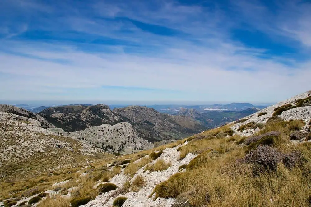
In the mountain range of Sierra de Grazalema in the province of Granada, you find some astounding hiking routes.
One of these is the loop trail passing the two peaks Simancón (1569m) and El Reloj (1535m). The hike starts by the campgrounds of Grazalema and continues up a pine forest before it opens up and you get the breathtaking views of the village of Grazalema and the mountains behind you.
The trail is badly marked, so I highly recommend downloading the Wikiloc app and following this track to avoid getting lost.
We didn’t follow a track the first time and got very lost between the peaks. While I’m an experienced hiker, the “shortcut” we took to return back after getting lost was not exactly one of my proudest hiking moments, so please stay safe on the trail and follow a route, these trails are really badly marked, but so incredibly beautiful!
Unlike many other hikes in Sierra de Grazalema, this hike does not require a permit.
Siete Lagunas
🎒HIKING SPECS:
🥾Difficulty: moderate-difficult
👣Length: 17.5 km
🚶♀️Hiking time: 7-9 hours
🧭Type: Linear return
Siete Lagunas is one of the most beautiful hikes in Spain’s Sierra Nevada. But it’s also a hard one, so make sure you have a decent level of fitness before you head out on this adventure.
The hike from Trevelez to Siete Lagunas is only 8.7 km one way, but it’s a brutal ascent of 1500 meters! It passes farmland, a pine forest, green meadows, rivers, and finally the astounding Chorrera Negra Waterfall. The views along this hike are breathtaking.
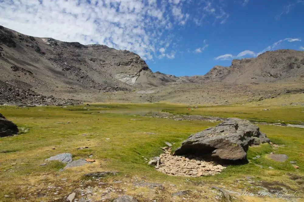
After the grueling final ascent along the waterfall, you’re finally at Siete Lagunas – which means the Seven Lagoons.
The green meadows dotted with lagoons that meet you are perfect for a break before heading back down. Or if you’re adventurous, continue up to Mulhacen or Alcazaba peak.
El Chullo
🎒HIKING SPECS:
🥾Difficulty: easy
👣Length: 9 km
🚶♀️Hiking time: 4 hours
🧭Type: Linear return
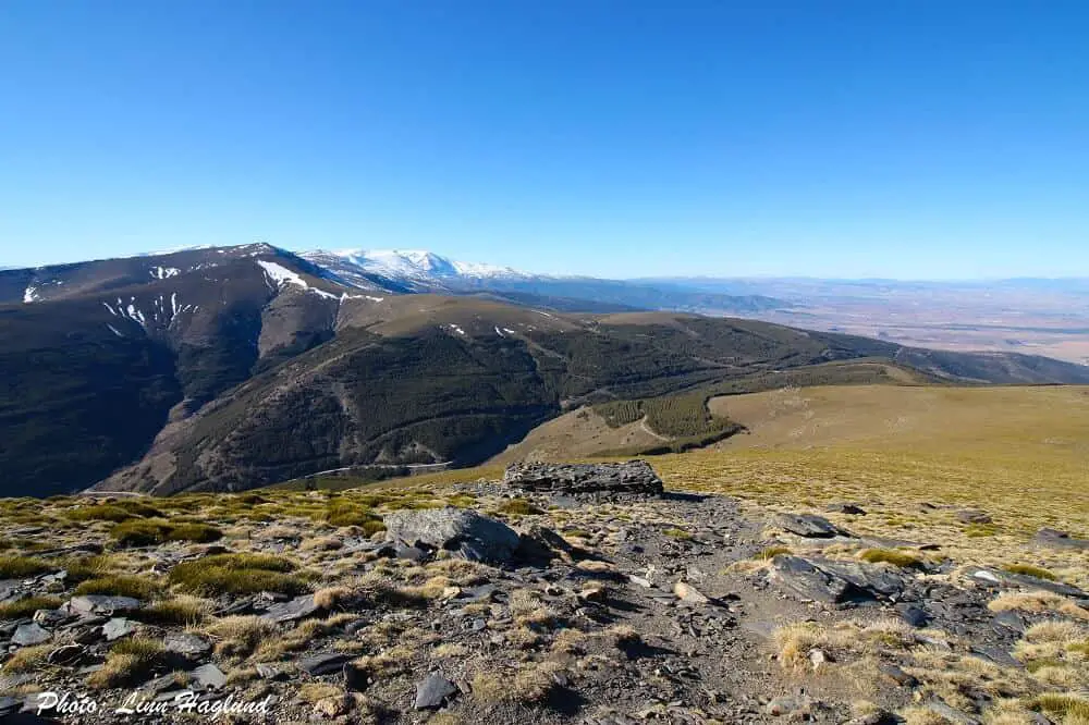
Almeria is not very famous for hiking, but truth is, a big chunk of Sierra Nevada’s National Park belongs to Almeria. And the province’s highest summit is in the national park.
El Chullo (2613 masl) is an easy-to-access mountain and you can do the return hike in only 4 hours. Including breaks.
This is a hike you can do all year round, though there is usually snow in winter, there are no steep or dangerous parts along the way so it’s still accessible.
The hike starts at Puerto de La Ragua, which is also a cross-country ski resort in the Sierra Nevada in winter.
The rest of the year this is even a hike you can do with kids and there’s a big chance of seeing wildlife like mountain goats.
Via Verde, Sierra Norte de Sevilla
🎒HIKING SPECS:
🥾Difficulty: easy
👣Length: 20 km
🚶♀️Hiking time: 5-6 hours
🧭Type: Linear
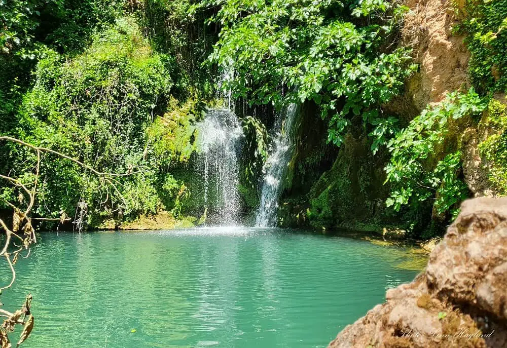
Not many people know that Seville boasts a lush mountainous area just an hour north of the city. One of the best hikes you can do there is the Via Verde.
It’s actually a perfect bike path that goes 20 kilometers from Isla Margarita to Cerro del Hierro.
The hike itself is not the most exciting with a lot of straight stretches, but the stops along the way are so worthwhile! About 15 kilometers go along the old railway.
Especially worth mentioning is Cascadas del Huesna (turn left into the forest right after the tunnel) with multiple astounding waterfalls and waterholes. Unfortunately, it’s not allowed to go swimming in the rivers in Sierra Norte de Sevilla.
Next, stop at San Nicolas del Puerto. A super cute village with an artificial beach. This is the perfect stop for buying cold drinks.
At the end of the trail, you’ll reach the Cerro del Hierro mining area. It’s a really cool natural monument that includes a little loop walk you can do in about half an hour.
If you don’t want to do the whole 20 kilometers, you can do the 10 kilometers between Camping Batán de Las Monjas and Cerro del Hierro and you’ll see all the above attractions.
This is a good one-day hike that most people divide in two or three days due to the stops along the way.
Pico Lucero
🎒HIKING SPECS:
🥾Difficulty: moderate
👣Length: 10.8 km
🚶♀️Hiking time: 4-5 hours
🧭Type: Linear return
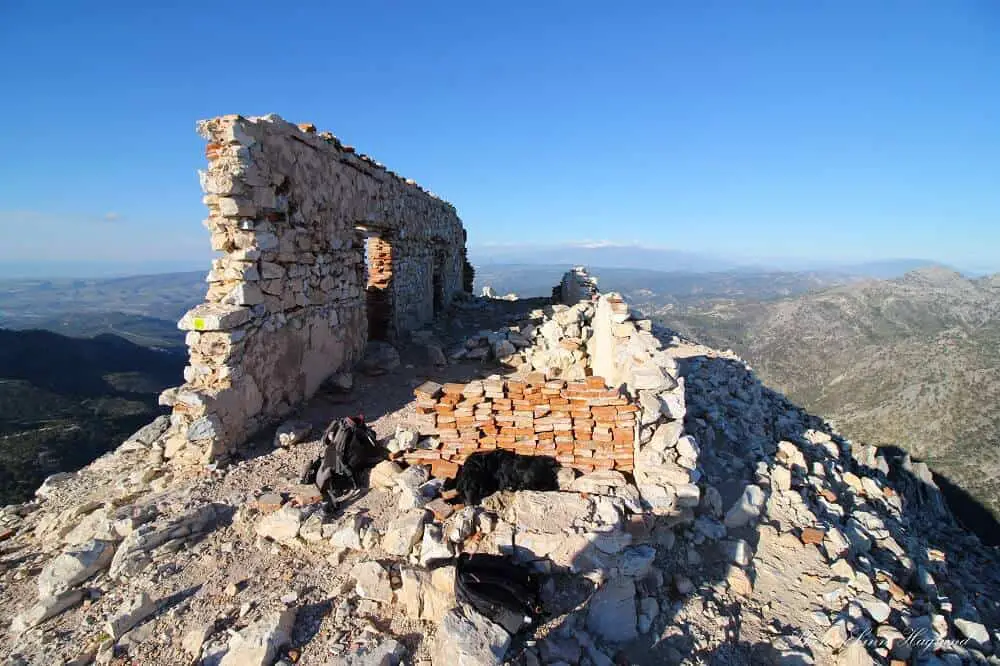
Pico Lucero (1779 masl), towering above Nerja with its astounding 360 views is a true bucket list hike! Starting from Puerto Blancillo above the village of Cómpeta is a medium to difficult-rated hike. Simply because you need to have a basic level of fitness to enjoy the route.
It has several steep sections, especially the last ascent up the actual peak. But it’s totally worth it. Not only is the natural scenery along the trail amazing all the way, but the mountain and the views are some of the best you get along Malaga’s coastline.
You can expect to hike for at least 5 hours, up and down, but most likely longer. Passing the mine, turn the first track to the right and continue until you see the signs to Pico Lucero on the right side by a little wooden bridge.
The iconic peak is recognized by the ruined refuge on the top.
Rio Chillar
🎒HIKING SPECS:
🥾Difficulty: easy to moderate
👣Length: 8 km
🚶♀️Hiking time: 6-7 hours
🧭Type: Linear return
🚨Rio Chillar is closed until further notice and will become a monitored hike with entrance tickets!
No list of hikes in Spain is complete without at least one river trek. Rio Chillar is the most popular river hike in Costa del Sol and an easy day trip from Malaga as it starts from Nerja, one of the best coastal towns in Spain.
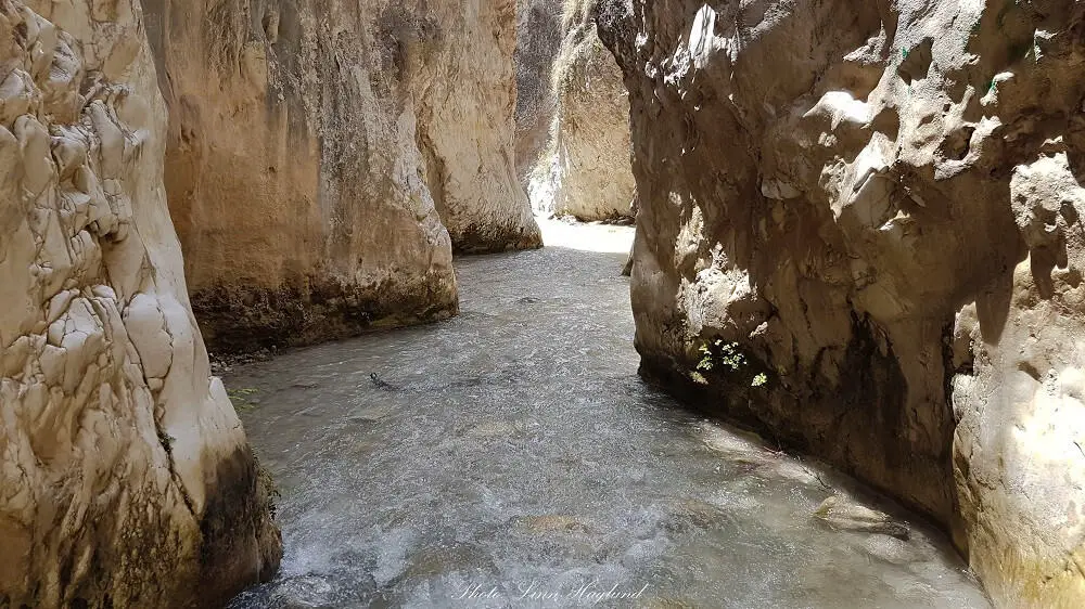
The 8-kilometer long trail goes along the Chillar River through beautiful, narrow gorges. This is perfect to do in summer, though there are fewer tourists once it gets to September.
In the winter months, it’s too cold to wade in the water for the 6-7 hours it takes to complete the trail there and back.
The trail has frequent water holes to swim in and there is shadow from the gorge and surrounding trees along most of the way.
Anyhow, I suggest you bring a hat. You will need to bring comfortable shoes that can get wet and don’t forget your swimwear!
The river ends with a small waterfall, where you can choose to turn around or you can continue in a loop.
Though you will not walk in the water if you opt for the loop, you will get rewarded with mesmerizing views as you walk above the gorge.
Rio Verde (Granada)
🎒HIKING SPECS:
🥾Difficulty: moderate
👣Length: 6 km
🚶♀️Hiking time: 2-3 hours
🧭Type: Linear return
Another river hike that’s absolutely worthy of reaching the list of the best hikes in Spain is the Rio Verde in Otívar, Granda. Make sure you drive from Almuñecar on the Granada coast and pass the village of Otívar.
A few kilometers after, on a windy mountain road, you’ll see a yellow ticket booth on the left. That’s where you enter and have to pay for entrance (5 Euros per person + vehicle.) Due to the hike being on private property, you can’t enter for free.
And remember not to mix this up with Rio Verde in Malaga (Istán).
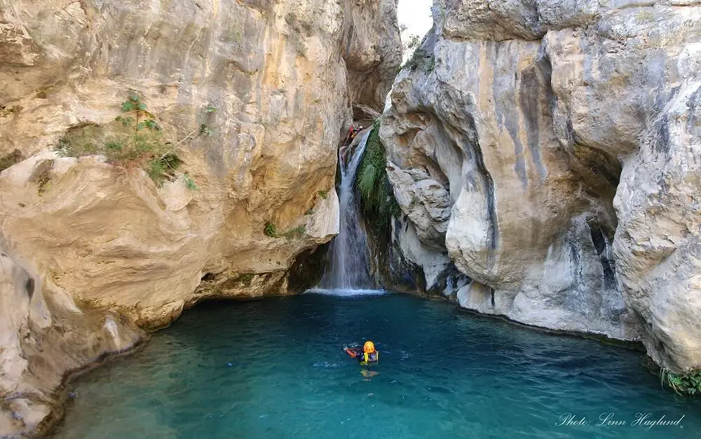
The hike itself is partly in water but mostly on trail. However, bring your swimwear for this hike as you’ll die to get into the natural waterholes along the river.
Being so lush and green with multiple waterfalls along the way, Rio Verde is a dream to walk in the hot summer months.
This is not a hard hike and makes the perfect family day out.
El Pinzapar
🎒HIKING SPECS:
🥾Difficulty: easy-moderate
👣Length: 10.9 km
🚶♀️Hiking time: 4-5 hours
🧭Type: Linear return
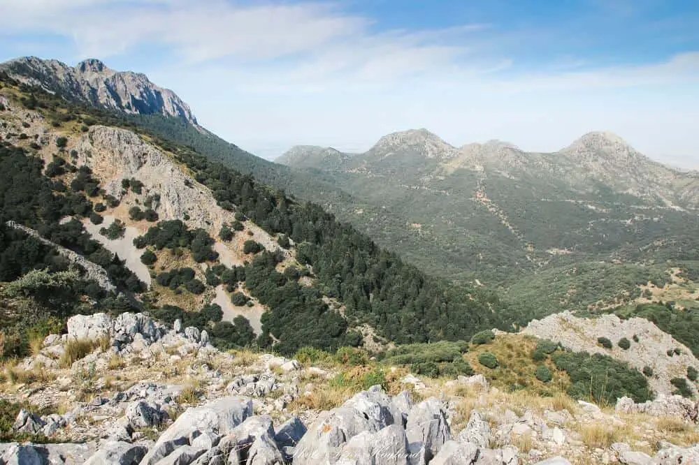
In the heart of Sierra de Grazalema, you find El Pinzapar trail showcasing the rare Pinzapo fir trees that can only be found in such a density in this area.
Starting by the white village of Grazalema, the hike takes you up to 1310 meters of altitude, through dense pine forest.
The views from the top are mesmerizing with the towering mountains behind Grazalema village on one side and the never-ending landscape spotted with pine trees and Pinzapo fir trees on the other side. Continuing down through the thick fir forest, the hike ends in Benamahoma.
Hiking there and back takes approximately 4-5 hours and it is necessary with a permit to enter the protected nature park.
You can get a permit both at the Grazalema and El Bosque Information centers. The permits are free of charge, but it fills quickly up at the weekends and other public holidays as it is a popular area for hiking.
La Concha
🎒HIKING SPECS:
🥾Difficulty: moderate
👣Length: 14 km
🚶♀️Hiking time: 7-8 hours
🧭Type: Linear return
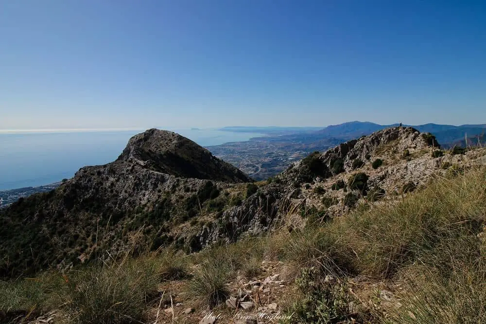
La Concha hike starts at Refugio de Juanar above Marbella in Costa del Sol. The start of the trail is pretty flat along a dirt road before it takes you through the olive groves to your right.
Once you enter the dense pine forest the trail gets steeper for the next half an hour before it opens up to mesmerizing views of the Mediterranean on the other side of the hill.
Turn right (not left, that will take you up to Cruz de Juanar) and continue along the top of the hill with sea views all the way.
A small detour around a smaller peak takes you along the steep cliffside before winding up to safety again.
Once you see the ridge you need to get past a few meters where the path is nearly non-existent and the only safety you have is a metal wire hooked onto the rock wall.
If you are scared of heights, don’t look down. Once this part is passed, walking the ridge is easy, but rocky.
The tip of La Concha has breathtaking views of Marbella. The hike takes about 6-7 hours including photo, lunch, and snack breaks.
Masca, Tenerife
🎒HIKING SPECS:
🥾Difficulty: moderate-demanding
👣Length: 10 km return
🚶♀️Hiking time: 4-5 hours
🧭Type: Linear return
By Paulina of Paulina On The Road
Tenerife is much more than a coveted holiday destination for beach and sun lovers. If you enjoy spectacular hikes, then, Tenerife should be on your travel bucket list.
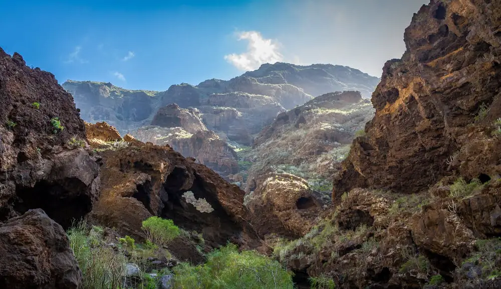
Probably one of the best and most emblematic hikes in Spain is the Masca trail. It takes you from the village of Masca through the spectacular canyon of Los Gigantes down to Masca beach.
Masca village had no paved road access until the 70s, that’s how it could preserve its authentic charm. I recommend having a cactus fruit in the village before starting your hike.
The hike takes about 3 hours in order to get to Masca beach. Please note that you need to take a boat to get from Masca Beach to Los Gigantes harbor. Unless you are super motivated and want to hike up the entire canyon.
Difficulty level if you hike down is easy-intermediate and the best time to go is in spring when the trail is less crowded. It’s an experience for the entire family and one of the best things to do in Tenerife with kids.
Please always inform yourself at the tourist board whether the trail is open.
Frances Route (The Camino de Santiago)
🎒HIKING SPECS:
🥾Difficulty: moderate-demanding
👣Length: 780 km
🚶♀️Hiking time: 31 days
🧭Type: Linear
By Carol of Wayfaring Views
The Camino de Santiago (or The Camino) is a 1,000-year-old network of pilgrimage routes that all end in Santiago Spain.
The cathedral in Santiago houses the remains of Saint James, and it’s long been a place for the faithful to seek forgiveness. In more modern times, many non-Catholics tackle the trail for self-discovery or the athletic challenge.
I’ve been twice, the first time was intended as a life reboot after deciding to leave my 9-5 life. The second, was because the Camino got into my blood and I wanted to explore more of the trail.
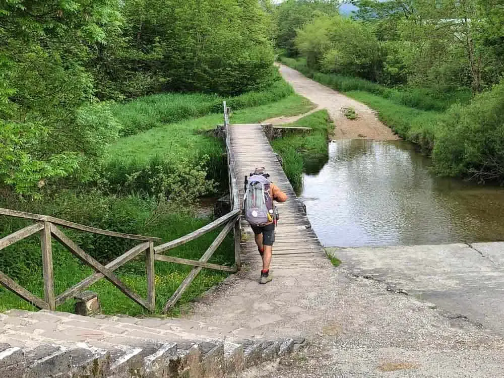
I took the Camino Frances, which is the most popular Camino trail. It covers 780 kilometers (500 miles) from St Jean Pied de Port, over the Pyrenees, and across northern Spain.
Walking the Camino is a very personal thing and you can do as much or as little of the trail as you wish. Most people take 30-45 days to complete it, sometimes over multiple years.
For the most favorable weather, the best time to do the Camino is May-October. If you wish to avoid crowds, go anytime but July-September.
You’ll need to spend some time training and planning for the Camino de Santiago. But, you don’t need a permit or any special equipment, other than a 35-liter backpack, three days of clothes and the will to keep walking. As they say on the trail… Buen Camino!
Camí dels Ganxos
🎒HIKING SPECS:
🥾Difficulty: Demanding
👣Length: 14.5 km
🚶♀️Hiking time: 7-8 hours
🧭Type: Loop
By Claudia of My Adventures Across The World
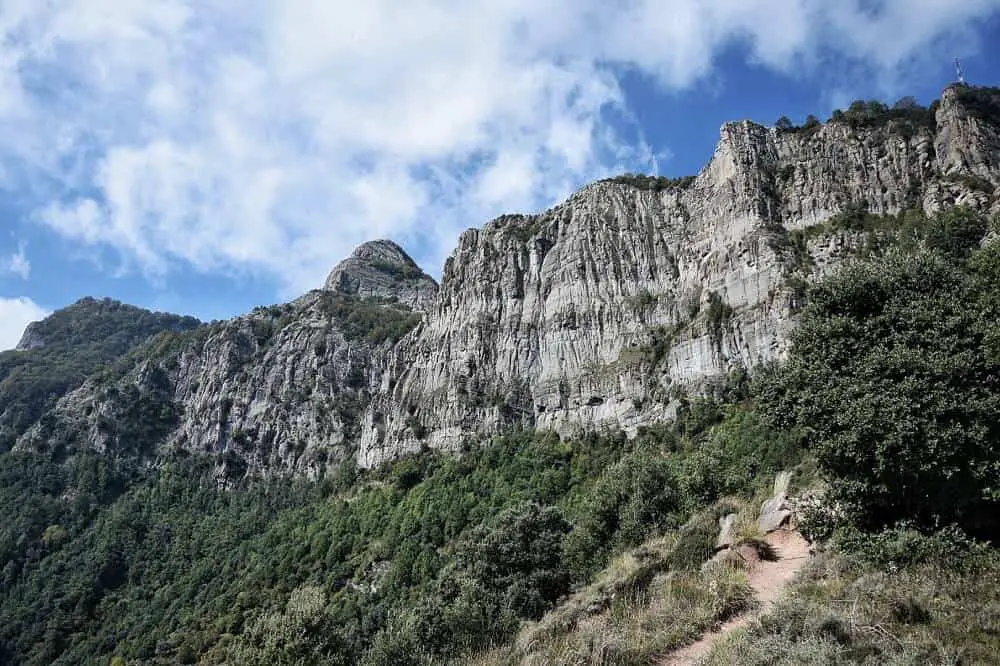
Camí dels Ganxos is one of the best hikes in Garrotxa, as well as one of the most challenging ones.
This is a circular trail that starts and ends on Joanetes and goes all the way to the Hermitage of Santa Magdalena on Les Agulles mountain, a church that was founded by the monks of Sant Mary of Besalú between 977 and 988.
The views are incredible throughout – you get to see a beautiful part of the Pyrenees, and the thick forest of this part of Catalonia.
The trail runs for about 14.5 km on a steep mountain, on uneven terrain. The path isn’t easy to follow – you have to look for the yellow marks on trees and rocks and some of them have been removed by rain, wind, and nature.
The first part is a steady ascent until you reach the “gantxos” – the hooks via which you have to lift yourself all the way to the plain where the hermitage is located.
There is no protection whatsoever in the area where the hooks are placed, so you really shouldn’t be hiking this trail alone – not unless you are a very experienced climber; and even then I do not recommend it.
The hike takes an overall 7 to 8 hours to complete – even though the signs along the route mark an overall waking distance of 5.5 hours, which seems to be a massive underestimation, given the difficulty of the trail.
There are no fountains along the trail, and you will have to take enough food and water for the duration of the hike. Make sure to also take a GPS and a torch with you, and only go if properly equipped with good hiking shoes.
Ruta del Cares
🎒HIKING SPECS:
🥾Difficulty: Moderate
👣Length: 24 km
🚶♀️Hiking time: 8 hours
🧭Type: Linear return
By Kevin of KEVMRC
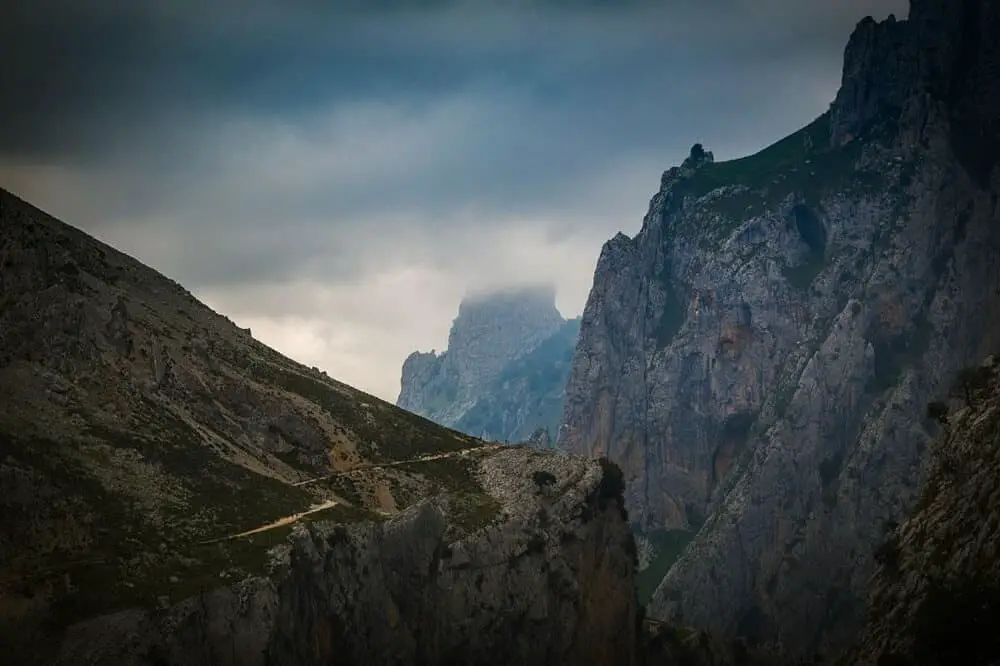
La Ruta del Cares, also known as the Cares Gorges Trail, is definitely one of the best hikes in Spain. The hike is located in the north of Spain, in the Picos de Europa National Park, the first National Park in Spain.
While there are quite a few hiking trails in the area, the one I’d recommend doing if you only had to choose one would be the Ruta del Cares.
This day hike will take you from Poncebos to another mountain village, Caín de Valdeón. What’s so special about this hike is the hike itself: it’s directly carved in the side of the mountain, and you’re guaranteed to have absolutely epic views for the whole hike!
In addition to the stunning views, you’ll get on the trail, you’ll also get to see quite a lot of wild animals during your hike: mountain goats, sheep, and horses.
Oh, and best of all? It’s not crowded and you’ll get to enjoy the peace & quiet of the mountains for most of the year; if you do go in July & August, it’s a bit more crowded but still enjoyable.
To get to the start of the hike, you can drive from Santander (1h30) or Bilbao (2h30). You can also get there by bus, but only in summer (from July 13th to September 1st): first get to Arenas de Cabrales, then take another bus to Poncebos.
Tips for responsible hiking in Spain
When hiking in Spain it is important to be a mindful hiker so that you contribute to protecting the natural beauty in the country. As a hiker, you should always aim for leaving no trace. That’s why I have put together a checklist for you so you don’t have to regret anything after your hike, and so that you go well prepared.
Bring a reusable water bottle
This is, needless to say, an essential even for your day hike packing list. While we speak about reducing single-use plastic waste at home, it is just as important to reduce single-use plastic waste when we are out in nature.
I love this eco-friendly steel bottle from Greens Steel. It keeps the water cold for the whole day and the brand is totally aligned with my ethos.
Though the water in Spain is perfectly drinkable, I know a lot of tourists think it tastes bad or just don’t want to drink it for whatever reason. If that is your case, or you just like to filter your water (there is a lot of lime in the water in Spain), this filtered water bottle from Brita is a good option.
Buy your snack locally
If you buy your snack locally in the closest village to where your hike starts you contribute to the local economy. It’s also a great way to get a sneak peek into the local village life.
Bring eco-friendly sunscreen
While hiking in Spain there is a big chance you will be exposed to large amounts of sun, even in winter. That’s why it’s important to bring sunscreen on your hike. Make sure you make it an eco-friendly one so it doesn’t affect the environment.
This sunscreen from Hello Bello is both eco-friendly, vegan, and cruelty-free).
Bring a bag for your waste
No need to say you shouldn’t leave any waste behind. Still, I have found myself far out on a hike and forgotten to bring a bag for my waste. With some inventive solutions, it usually sorts itself out, though.
While you might be good at bringing your own trash back down from a hike, it doesn’t hurt to pick up whatever you find on the trail too.
Respect the wildlife
You might meet wildlife while hiking in Spain. Make sure you don’t interfere in any way, don’t chase the animals to get a better photo, and definitely don’t feed them.
This is important for two reasons, mainly because whatever you have in hand is surely not that animal’s natural diet. And secondly, you don’t want to make the wildlife used to ask people for food and maybe even venture down to the towns for human food where they might get hit by cars on the road.
Stick to the marked path
By staying on the marked path you make sure you don’t interfere with the natural fauna. Stepping on plants can have many effects. Other species can be dependent on these plants for their survival and when hikers step on them they can ruin small areas so that bugs and other animals lose their homes and food.
When is the best time to hike in Spain?
Depending on the hiking trail you’re planning to take, different seasons are more adequate to hike in Spain. I’ll give you a short insight so you can pick the best time for your hiking adventure.
In the hot summer months from mid-June to mid-September, going for any low-altitude hikes that don’t include hiking in a river, is complete madness. The temperatures are too high to enjoy the hike and you would need buckets of water to drink and pore over your head.
However, if you are hiking up high-altitude peaks like Mulhacen, then summer is ideal as the trails will be covered in snow in the winter, thus dangerous to ascend without a guide.
Also river hikes are great in summer, often they bring natural shade by a gorge or surrounding trees while the river cools you down.
Any other hikes are recommended in the autumn and spring. Depending on how far south in Spain you are, even the winter months are perfect for hiking.
Maybe even the best months if you ask me, as temperatures are mild and pleasant. However, if you are north in the country it can be colder, but still beautiful.
How to get to Spain
Before we look at some of the best hikes in Spain, let’s look at how to get to Spain in the first place. As a center of tourism in Europe, Spain was the most equipped country to receive tourists in 2019 according to CNBC, so getting there should be fairly easy from most places in the world.
By plane
There are more than 35 international airports spread around the country (including the islands), so it’s easy to pick an airport close to your hiking destination. Flights are frequent to most airports too.
By train
The rail connections with the rest of Europe are pretty good for the big cities. However, they might not take you everywhere you want to go hiking in Spain.
Nevertheless, Spain is included in the Eurail Global Pass if you are traveling around Europe by train.
Trains in Spain are in good condition and usually run on time. There is also the AVE High-Speed train that runs between the major cities of Madrid and Barcelona connecting with Valencia, Cordoba, Seville, and Malaga.
By bus
Spain is also well connected to the rest of Europe, and even to Morocco in Africa, by bus. Once you get to the major cities there are usually bus connections to different hiking routes around the area, though not always as frequent as one should wish, so it’s worth checking up the bus hours in advance.
By car
Also by car, it’s easy to access Spain from the rest of Europe and from Morocco in Africa. There are frequent ferries from Tangier in Morocco to Algeciras or Tarifa in Spain that only take 30 minutes to an hour. Another option is to cross the border to Ceuta (Spanish territory on the African continent) and take the ferry from there.
Otherwise, Spain borders Portugal and France in Europe and roads are in good condition. It’s not normal to be stopped at border crossings as all these countries are in the European Union so the driving goes pretty smoothly.
Traveling by car also assures you the easiest access to any of the below Spain hiking trails.
Reflections on hiking in Spain
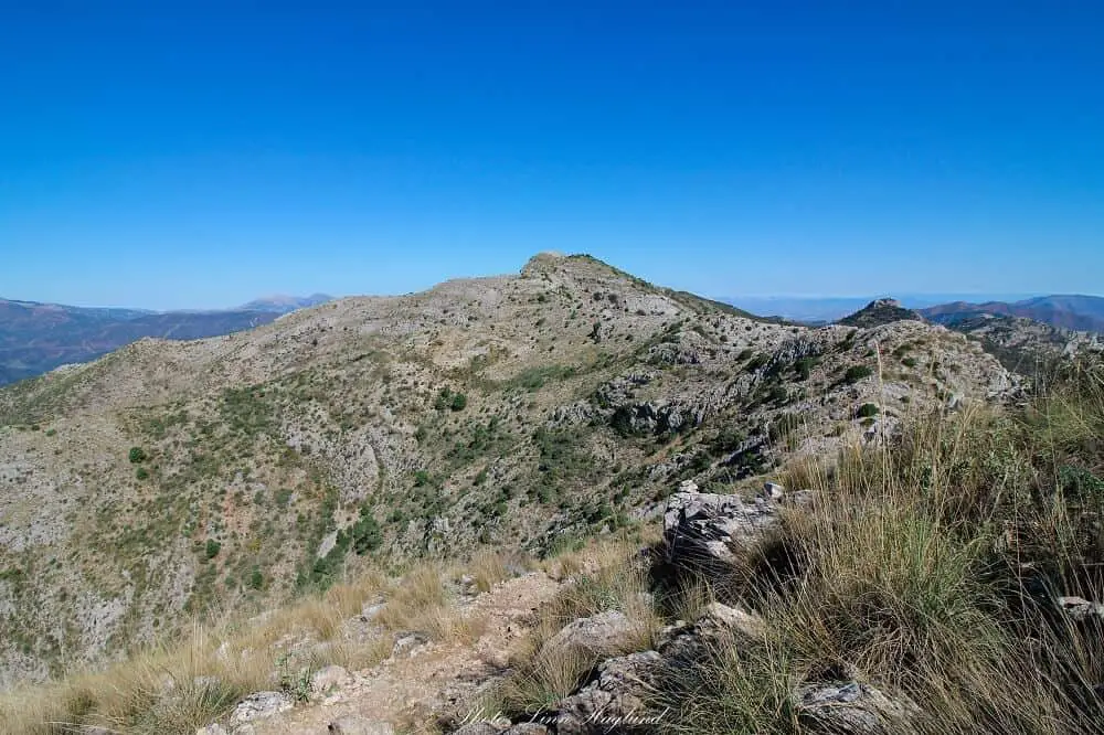
As you can tell, hiking in Spain is nothing short of fabulous! There is so much variety and you find anything from easy hikes to difficult treks so there’s something for every level.
After exploring the hiking routes in Spain for over a decade my hiking bucket list just grows and grows and I can’t recommend it enough!
Pin it for later!
[mc4wp_form id=”1220″]

I just moved to Spain in September and I keep reading articles that make me fall more and more in love with this country. These hikes look absolutely gorgeous. Adding them all to my list.
Awesome! Welcome to Spain! You will surely have a lot of great hiking experiences with these ones:)